- News
- Reviews
- Travel & Adventure
- Interviews
- Inside Industry Players
- Community
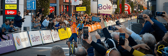
Bikes
Reviews
Components
Reviews
Cycling
Apparel

[raw_mobile_menu]
[wpml_language_switcher_down]

La segunda edición de nuestro evento Touch and Go tuvo lugar el pasado fin de semana (3-5 de marzo) y, pese a que la logística nos provocó más de un quebradero de cabeza, las buenas sensaciones con las que volvimos a casa disiparon cualquier duda acerca de la factibilidad de esta aventura. Al igual que en la primera edición en Mallorca, el territorio a conquistar fue una isla del Mediterraneo, pero esta vez cambiando a Francia para cruzar la isla de Córcega de este a oeste en menos de doce horas.

La idea trás Touch and Go reside en maximizar el tiempo de un fin de semana. Mientras los ciclistas profesionales viajan a sitios distantes buscando el buen tiempo para hacer training camps, los ciclistas aficionados lo tienen más complicado debido a sus responsabilidades laborales. Con Touch and Go se propone optimizar la parte de viajar al destino durmiendo para aprovechar al máximo un fin de semana.
Con todos los posibles puertos de salida o llegada sobre la mesa, una exhaustiva recopilación de las horas de partida de ferries nos llevó a la conclusión de que la combinación Toulon-Bastia y Ajaccio-Toulon era la única que nos permitía disponer del tiempo suficiente para cruzar gran parte de Córcega en un solo día. Así, el viernes dormiríamos en el ferry para amanecer en Bastia y regresar el mismo sábado para despertar de nuevo en el continente.


A la hora de trazar la ruta, siempre buscando esas carreteras menos transitadas y puertos más espectaculares, tuvimos que tener en cuenta la hora de partida del ferry de vuelta al continente. Así, dimos con una ruta de 192 kilómetros con casi 4.000 metros de desnivel positivo para la que dispondríamos menos de 12 horas para completar. Siendo conocedores de todos los percances que podrían ocurrir en el camino, el margen de error era mínimo.


Todo esto se decidió con bastante tiempo de adelanto, pero durante las semanas previas a la fecha marcada pasamos horas y horas viendo la evolución de la meteorología en la isla. Uno puede pensar que en una isla del Mediterráneo, por lógica, la temperatura nunca será especialmente fría, pero Córcega es una isla que tiene todos los climas, con su pico más alto el Monte Cinto de 2.706 m. Así, cuando a escasos días del evento la nieve cubría gran parte de las carreteras por las que teníamos intención de transitar, muchas dudas merodearon nuestras cabezas.
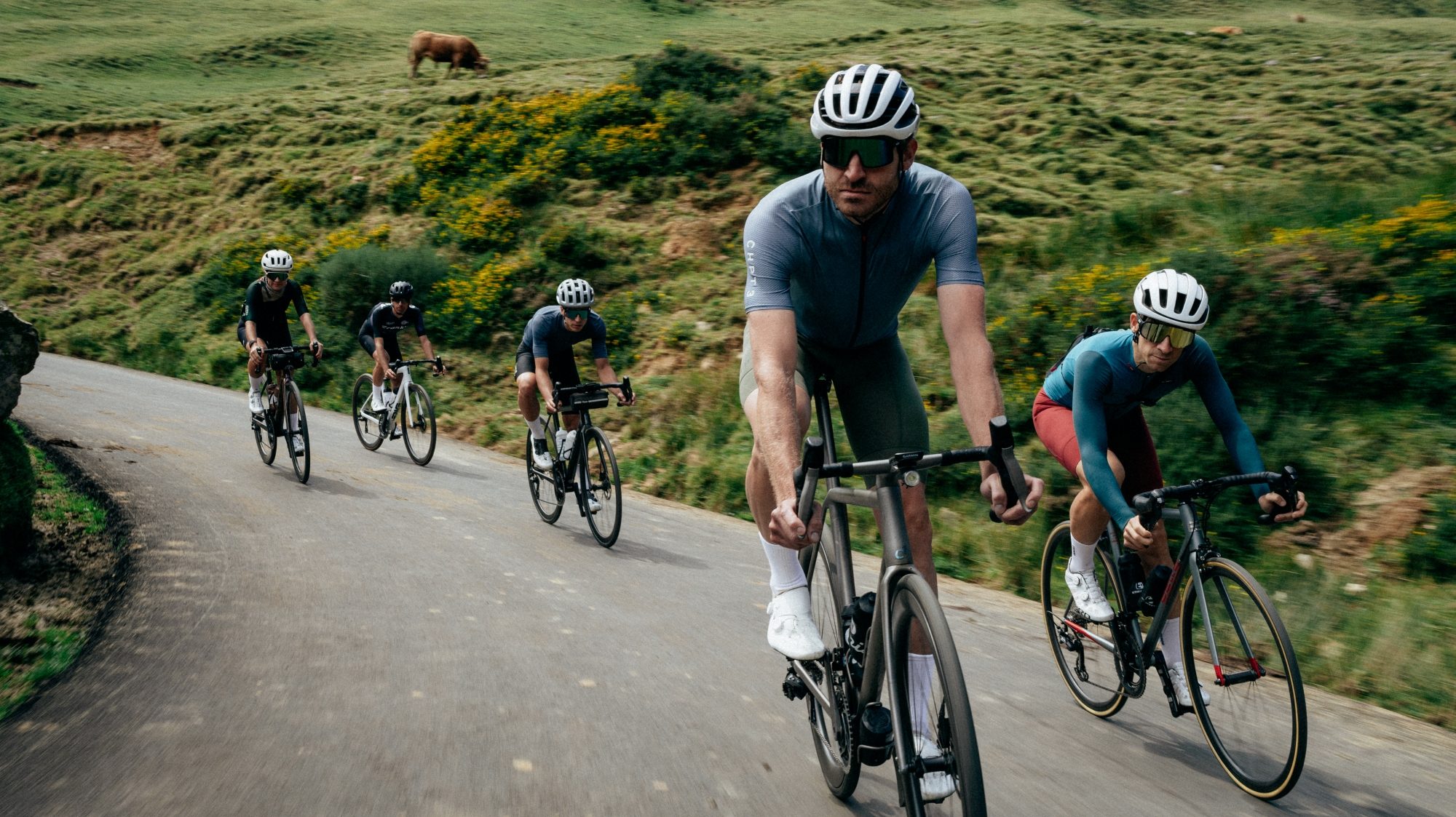
Finalmente el tiempo estuvo de nuestro lado y los 16 ciclistas pudimos disfrutar de un gran día sobre la bici. Aun así el tema principal en los minutos previos al inicio de la ruta fue cuánto abrigarse y cómo guardar toda la comida que teníamos intención de llevar con nosotros.


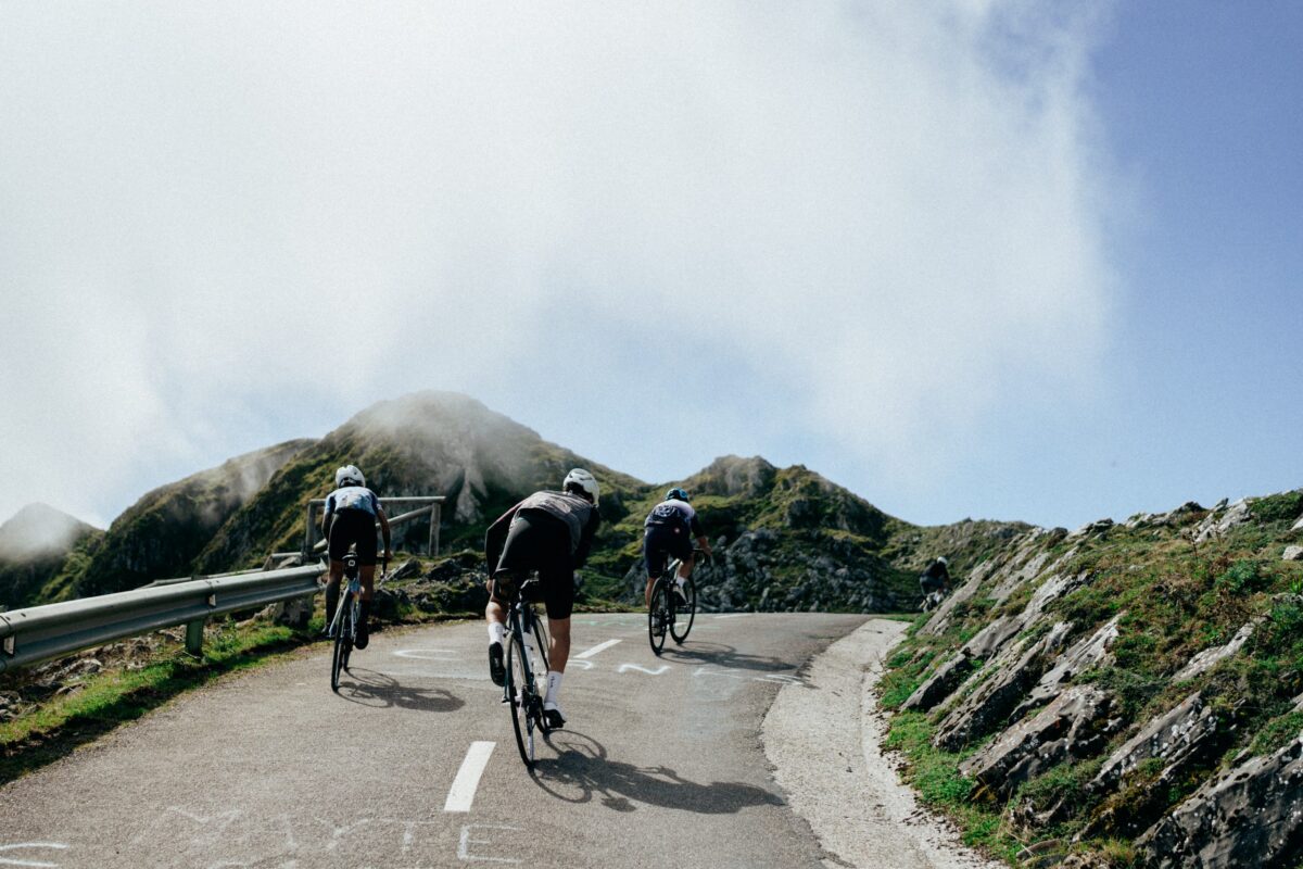
Hubo varias ocasiones a lo largo de la ruta en las que nos quedamos boquiabiertos al apreciar el paisaje que se abría ante nosotros. Aun tenemos grabado en la mente el momento en el que, a lo largo de un tramo de sube y baja justo después de coronar el primer puerto Col de Bigorno (885 m), pudimos ver desde la distancia los picos más altos de la isla totalmente cubiertos de nieve. Si uno no supiera que está en una isla, juraría que lo han soltado en medio de los Alpes.


Sabíamos que un par de horas después íbamos a estar ahí arriba, y las ganas de rodar por la nieve se enfrentaron a la inquietud de no saber en qué estado iban a estar las carreteras que nos llevarían hasta allí. Ya habíamos pasado por tramos en los que el deshielo había creado verdaderos ríos que cruzaban la carretera, así que era lógico pensar que a medida que continuáramos ascendiendo el estado sería peor.
La primera parada organizada se produjo en el tramo llano entre la primera y segunda ascensión del día, cuando ya habíamos recorrido un tercio de la ruta. Nos abastecimos en un supermercado e intentamos sacarnos cuanto antes de encima el único tramo de carretera principal.


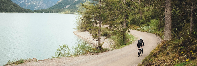
Esos 10 km valieron la pena ya que fue girar hacia la derecha en Francardo y tanto la carretera como el paisaje cambió por completo una vez más. La primera parte del Col de Vergio (1.477m) nos llevó por un cañón (Scala di Santa Regina) con vistas a las altas montañas frente a nosotros. Uno podía escuchar cosas como “uau” o “qué bonito” cada vez que tomábamos una curva y nos encontrábamos con algo nuevo al salir de ella.
Dada la longitud de la subida principal y la hora del día en ese momento, decidimos realizar la pausa para la comida en un punto intermedio de la ascensión en Calacuccia, aprovechando para reagruparnos y coger fuerzas para la segunda parte. Las pendientes que nos quedaban por delante no eran muy pronunciadas así que pudimos permitirnos el lujo de llenar nuestros estómagos con un buen plato de pasta y galletas caseras.


Esta segunda parte se caracterizó por el excelente estado de las carreteras a través de bosques de altos pinos. A falta de más de 10 kilómetros para coronar empezamos a adentrarnos en un paisaje cada vez más nevado a ambos lados de la carretera. Si al inicio de la ruta veíamos el mar, a escasos kilómetros de la cima del Vergio pasamos a circular por verdaderas paredes de nieve.

De la misma forma que en una isla tropical existe el riesgo de que un coco te caiga en la cabeza, aquí casi tuvimos algún accidente con los bloques de nieve que caían por el deshielo de las copas de los pinos. En ese punto el silencio nos rodeaba, y sólo estos pequeños desprendimientos alteraban el sonido de nuestra acelerada respiración.
Parecía mentira que estuviéramos a tanta altura y rodeados de nieve en una isla. La temperatura era relativamente buena, con una mínima de 3°C, pero el sol calentaba y permitió a los primeros en llegar a la cima esperar tranquilamente al resto.


Para el descenso nos cubrimos con toda la ropa que teníamos, conocedores de lo que significa descender en invierno. Dato curioso, el ganado en Córcega es totalmente libre, de modo que hay que bajar y tomar las curvas con especial atención ya que es fácil encontrarse cerdos, caballos o vacas en mitad de la carretera. Ellos están en su territorioy se pasean libremente.

El descenso hacía la playa fue partido por un pequeño puerto que muchos no esperábamos, pero que tomamos tranquilamente para seguir el sol que nos guiaba el camino. Ya transitando una parte plana de la costa, nos quedamos de nuevo atónitos al ver el juego de luces de la puesta de sol con las olas del mar, la arena de la playa y las montañas siempre presentes que nos acompañaban hasta la parte más baja.
Ya al límite de nuestras fuerzas coronamos el último puerto Bocca San Bastiano (411 m) y nos reagrupamos viendo el sol caer dentro del mar para descender tranquilamente a Ajaccio. Lo habíamos conseguido. Sin vías de escape y una ruta de lo más difícil aunque preciosa, habíamos cruzado la isla en dirección suroeste en un solo día, exprimiendo al máximo el fin de semana. Además, antes de montarnos al ferry de nuevo, nos quedó tiempo para permitirnos unas pizzas más que merecidas.


Nos habían hablado muy bien acerca de las posibilidades que Córcega ofrece, de ese punto salvaje y aún sin explotar a nivel turístico y, sin duda, la realidad superó con creces las expectativas que teníamos de esta isla. Fue una sensación muy especial saber que estábamos en una isla, practicando ciclismo y haciendo turismo a la vez, pero que solo íbamos a estar ahí dureante un periodo de tiempo muy corto. Todo tipo de emociones estaban flotando en el aire a medida que nos mimetizamos con la naturaleza y nos unimos como grupo.

Se creó un recuerdo precioso a la vez que conexiones inmediatas con todos. Así pues solo nos queda hacer una pregunta, ¿cuál será el siguiente destino de Touch and Go?
Apasionado de la bici y de la competición, Pol, siempre está preparado para una nueva aventura. Le encanta la sensación de ponerse un dorsal y es un auténtico adicto al ciclocros. Passionate about bikes and racing, Pol is always ready for a new adventure. He loves the feeling of pinning a number and he is truly addicted to cyclocross. View all posts by Pol Sopeña
The second edition of our Touch and Go event took place last weekend (March 3-5) and, even though the logistics were not easy to deal with, the good feeling we came back with made this adventure totally worth it and proved its feasibility. Like in the first edition in Mallorca, the territory to be conquered was an island in the Mediterranean, but this time switching to France to cross the island of Corsica from east to west in less than twelve hours.
The idea behind Touch and Go is to make the most of a weekend. While professional cyclists travel to distant places looking for good weather to go to training camps, amateur cyclists find it more difficult given their work responsibilities. With Touch and Go we intend to optimize the traveling part to the destination by sleeping over and making the most of a weekend.
With all possible ports of departure and arrival on the table, an exhaustive compilation of ferry crossing times led us to the conclusion that the Toulon-Bastia and Ajaccio-Toulon combination was the only one that allowed us enough time to cross a large part of Corsica in a single day. Thus, on Friday we would sleep on the ferry to wake up in Bastia and return on Saturday night to the continent.
When planning the route in a quest to find the less-traveled roads and more spectacular climbs, we always had to consider the departure time of the ferry back to the mainland. Therefore, we set a 192-kilometer route with almost 4,000 meters of elevation gain for which we would have less than 12 hours to complete. One way or another we had to make the most of our limited time on the island, always being aware of all the mishaps that could occur along the way.
All this was decided well in advance, but during the weeks before the planned date, we spent hours and hours watching the evolution of the weather on the island. One might think that on a Mediterranean island, logically, the temperature will never be particularly cold, but Corsica is an island that has all climates, with its highest peak being Monte Cinto at 2,706 m. Given that, when a few days before the event the snow covered a large part of the roads through which we intended to ride, and many doubts lurked in our heads.
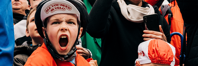
Finally, the weather was on our side and the 16 cyclists were able to enjoy a great day on the bike. Even so, the main conversation topic minutes before the start of the route was how many clothes to put on and how to store all the food we intended to take with us.
There were several jaw-dropping moments along the route when we discovered the landscape that appeared in front of us. We still remember the exact point at which, along a section of rolling and winding terrain just after reaching the first pass Col de Bigorno (885 m), we saw the highest peaks of the island from a distance totally covered with snow. If we had not known we were on an island, we would have sworn we were in the middle of the Alps.
We knew that a couple of hours later we were going to be up there, and the desire to roll through the snow clashed with the concern of not knowing what would be the state of the roads there. We had already gone through sections in which the snowmelt had created proper rivers that crossed the roads, so it was logical to think that the conditions would worsen as we continued ascending.
The first organized stop occurred in the flat section between the first and second ascent of the day when we had already covered a third of the route. We stocked up at a supermarket and tried to get rid of the only stretch of the main road as soon as possible.
After 10 km we turned right on Francardo and both the road and the landscape changed completely once again. The first part of the Col de Vergio (1,477m) took us through a canyon (Scala di Santa Regina) with views of the high mountains in front of us. One could hear things like “wow!” or “how beautiful!” every time we took a turn and found something new on the other side.
Given the length of the main climb and the time of day at that moment, we decided to take a break for lunch at an intermediate point of the ascent in Calacuccia, taking the opportunity to regroup and gain some strength for the second part. The slopes ahead of us were not very steep so we could afford to fill our stomachs with a good plate of pasta and homemade cookies.
This second part was characterized by the excellent condition of the roads through tall pine forests. With more than 10 kilometers to reach the top, we gradually entered an increasingly snowy landscape on both sides of the road. If at the beginning of the route, we saw the sea, a few kilometers from the top of Vergio we went through real snow walls.
In the same way that on a tropical island there is a risk of a coconut falling on your head, here we almost had an accident with the blocks of snow that fell from the treetops. At that point silence surrounded us, and only those snowslides stood out from our accelerated breathing.
It seemed incredible that we were at such altitude and surrounded by snow on an island. The temperature was relatively good, with a minimum of 3°C, but the sun was warming us enough and allowed the first to reach the top to wait without any hurry for the group to gather.
For the descent we covered ourselves with all the clothes we had, knowing what it means to ride downhill in winter. A curious fact, the cattle in Corsica are completely free, so you have to take turns as you descend with special attention since it is easy to find pigs, horses, or cows in the middle of the road. They are at home and they walk freely.
The descent towards the beach was split by a small hill in the middle part that many of us were not expecting. However, we took it at an easy pace and followed the sunrays that led the way. Already riding through a flat part along the coast, we were once again stunned to see the color palette of the sunset lights mixed with the waves of the sea, the sand of the beach, and the ever-present mountains.
Already running out of energy, we reached the summit of the last mountain pass of Bocca San Bastiano (411 m) and we regrouped watching the sun fall into the sea to calmly descend to Ajaccio. We had made it. With a challenging route and no possible shortcuts to take, we had crossed the island from east to west in a single day, getting the most out of the weekend. In addition, before getting on the ferry again, we had time to allow ourselves some well-deserved pizzas.
Friends had told us about the possibilities Corsica offers, and about the wildness and still unexploited areas it has but, without any doubt, reality has far exceeded the expectations we had of this island. It was a very rare feeling to know that we were on an island, cycling, and sightseeing at the same time, and just for a very limited time. All kinds of emotions were floating in the air as we merged with nature and we forged a sense of companionship with the whole group.
A precious memory was created as well as immediate connections with everyone. So, there is only one question left to ask; where will the next Touch and Go take us?
Apasionado de la bici y de la competición, Pol, siempre está preparado para una nueva aventura. Le encanta la sensación de ponerse un dorsal y es un auténtico adicto al ciclocros. Passionate about bikes and racing, Pol is always ready for a new adventure. He loves the feeling of pinning a number and he is truly addicted to cyclocross. View all posts by Pol Sopeña


Receive our monthly selection of the best articles, news, exclusive content and giveaways only for subscribers, subscribe to OUR NEWSLETTER
Receive our monthly selection of the best articles, news, exclusive content and giveaways only for subscribers, subscribe to OUR NEWSLETTER
Receive our monthly selection of the best articles, news, exclusive content and giveaways only for subscribers, subscribe to OUR NEWSLETTER
Receive our monthly selection of the best articles, news, exclusive content and giveaways only for subscribers, subscribe to OUR NEWSLETTER