- News
- Reviews
- Travel & Adventure
- Interviews
- Inside Industry Players
- Community
Bikes
Reviews
Components
Reviews
Cycling
Apparel

[raw_mobile_menu]
[wpml_language_switcher_down]

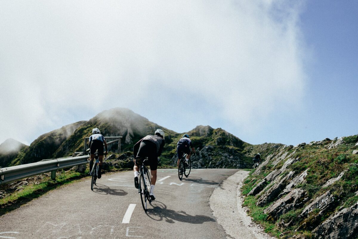
The French Vosges are probably unknown to those living in the southern part of Europe, but this mountain range is the go-to destination of cyclists from the Benelux area and beyond, looking for the long climbs that they lack where they reside, without the need to go all the way down to the Alps or the Pyrenees.
Located in Eastern France, near its border with Germany, these mountains are the chosen region of this ‘Places to Ride’ article because we want to highlight the aspects that turn the Vosges into potentially your next cycling destination.

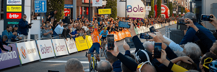
The decisive stages of the Tour de France usually take place in the Pyrenees and the Alps, but over the last couple of years the Vosges have played a key role – or at least that was what the organizers intended – in the outcome of the race. The second to last stage of the 2023 Tour de France was a short but intense route, climbing several of the toughest climbs in the region. Last year, the last stage of the Tour de France Femmes saw the riders grind their teeth up Le Markstein to decide the battle for the yellow jersey and win the first female edition of the French race in over 30 years. Some of the most prestigious sportives also take place in this area. Les 3 Ballons, the Granfondo Vosges or L’Alsacienne are not the average cyclo for recreative cyclists, and riders from France and neighboring countries set them as one of the goals of their year.


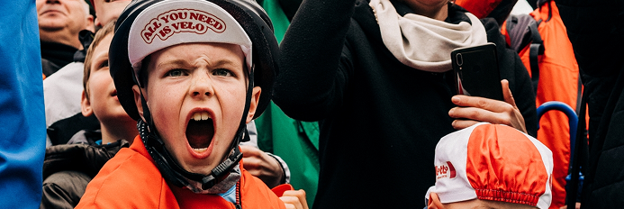
We have visited the Vosges a couple of times over the last few months, and our experience has been very positive. Last July we didn’t want to miss the occasion to see the Tour de France stage live, and even if the race had been already decided by then, we really enjoyed ourselves. We climbed Le Petit Ballon and the Platzerwasel on the same day as the pros, when the crowds had already populated both sides of the road and cheered for any rider passing by.
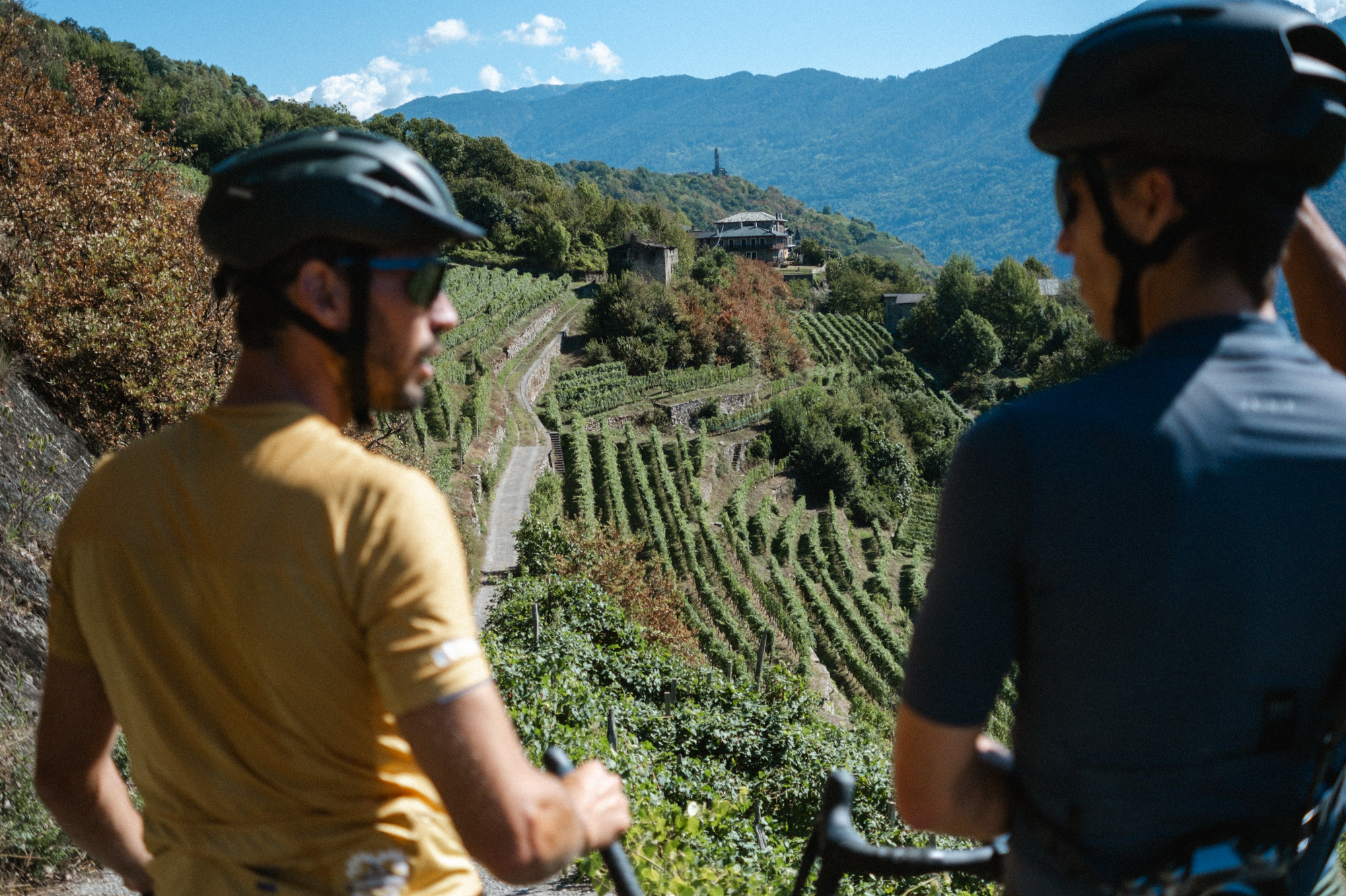
That time we were based in Colmar, in the middle of Alsace. From there one can warm up during the first few kilometers while getting out of the city and into the mountains, riding alongside the vineyards that populate the region. Nonetheless, if you want to start climbing right away, La Bresse is perfectly located in the middle of the Vosges and allows you to tackle several climbs in a single ride.

One of the main arguments for going on a cycling holiday to the Vosges instead of the Alps is the possibility of planning routes that resemble a proper loop and not an out-and-back. For example, the Galibier, given its length and its remote location, cannot be included in a feasible, circular loop. Instead, there is not a single road leading to the top of the climbs in the Vosges, and one can plan several routes with barely any road overlap. For example, Le Grand Ballon has seven ways to the top, ranging from 10 to 25 kilometers in length, and with moderate average incline.
No one is denying that there is nothing like reaching the top of a climb topping at over 2.000 meters after a +20km ascent, but it breaks all training schemes. The climbs in the Vosges are not as high but their length is optimal for any possible prescribed effort. Le Grand Ballon is the highest mountain with its 1.424 m of elevation, and the highest point you can get to with a road bike is 1.325 m. In summary, the road density and the moderate toughness of the climbs mean that the French Vosges are a very valid destination to spend a handful of days both as a recreational cyclist and a structured athlete looking to optimize their performance.
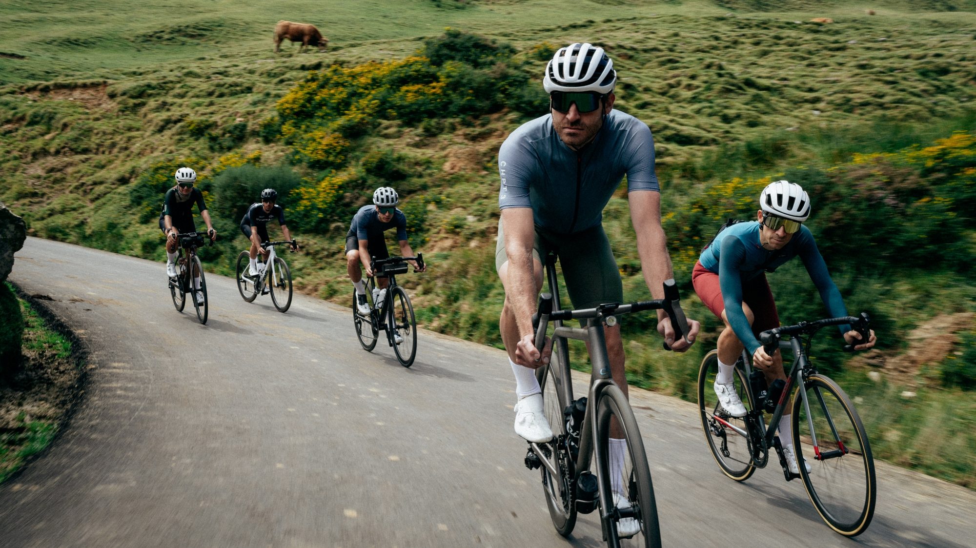
We recently stayed for a weekend in the region with our friends from Peloton de Paris, and the ride we did on Sunday is worth highlighting. We strongly recommend you follow it if you want to make the most of the region.


Starting from Le Régit, a handful of kilometers from La Bresse, the first seven kilometers are uphill in order to get to de Route des Crêtes, which we would follow for the next 25 km.
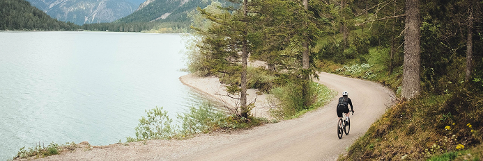
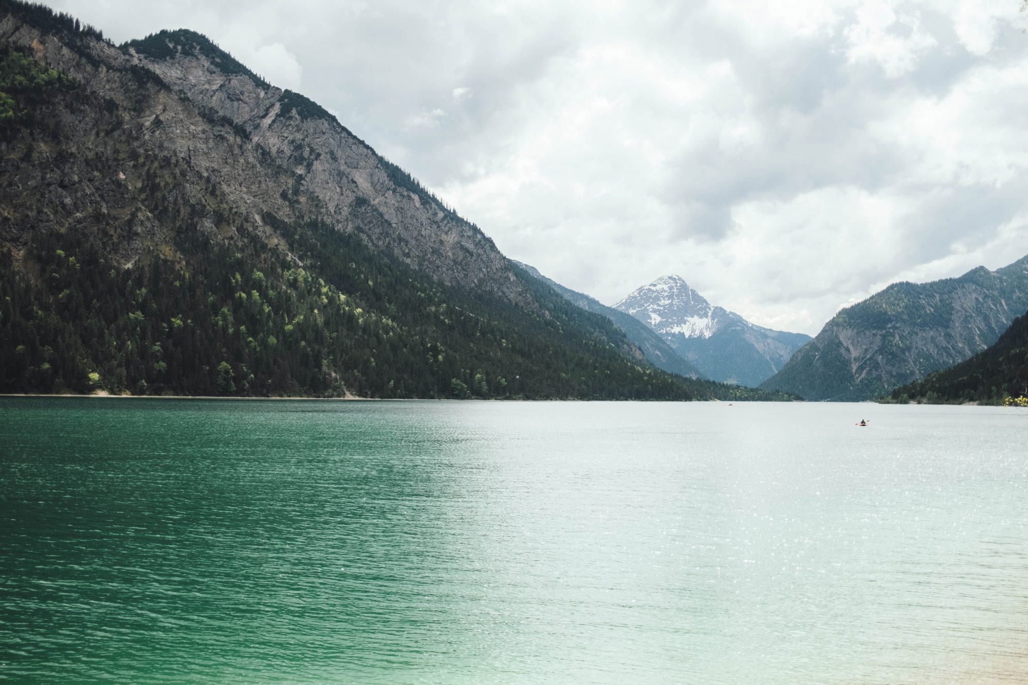
The landscapes along the proposed routes are very varied. There are parts where the deep forest of high pine trees, similar to what one could find in the Black Forest region in Germany, prevents the sunrays from hitting the road. On the contrary, the plateau following the Route des Crêtes is very exposed and allows you to see the vast pastures around you. Not only the views but also the surfaces along the way are very changing too. From the wide roads leading to the top of the major summits to the broken tarmac segments when trying to avoid the main roads, the Vosges are not monotonous at all.


The sun was shining and the vibes were high, so in no time we had the Grand Ballon in sight. As its name says, there is a balloon-shaped infrastructure at the top, more specifically an air traffic radar. Nonetheless, the ‘ballon’ of the name does not refer to the structure at the top but to the shape of the summit, which is more rounded than the typical rocky peaks. It also reminded us of Mt. Ventoux given how windy it was around the top, turning a pleasant descent into a focus exercise to make sure we weren’t blown away.
If we use La Bresse as a reference point, the climbs to the east of the village are considered to be tougher. Nonetheless, we were aware that Ballon d’Alsace should be on the bucket list of anyone riding in the Vosges so we wanted to include it in the route too.
The most common side to climb this climb is from Giromagny, but we tackled the climb coming from the east, after circulating for over 10 kilometers along a well-designed bike path. During the first 5 km of the climb we were surrounded by tall trees and the gradient was around 7-8%, but the second half, once we linked with the main road, was more exposed and with uneven slopes.


With already tired legs, we may have preferred to go back to the accommodation through the fastest way instead of the secondary roads we initially planned, but those last kilometers were peaceful and rewarding.


For the second suggested route, we replicate the second half of the 20th stage of the 2023 Tour de France, and then descend back to the starting point. The pros did 133 km with 3.400 meters of elevation gain; this route is just below the 3.000 meters of accumulated elevation over 112 kilometers.
Instead of starting by climbing the Col de la Schlucht, which is simply a main road with a gradually ascending tendency, the route leads us to Hohneck via a steep road passing by the Lac de Blanchemer. Hohneck is a concatenate of hairpins and the top at 1.363 m is the second highest in the Vosges, just after Le Grand Ballon.
The following 23 kilometers are downhill, allowing you to rest ahead of the two big climbs ahead. Do not underestimate Le Petit Ballon given its name, as it is tougher than its big brother. The climb starts in Munster and you accumulate 770 meters of elevation in less than 10 kilometers, resulting in an average gradient of around 8%, including a segment at 15%. Most of the climb is hidden in shade, which attenuates the high temperatures of summer, but at some points two-thirds into the climb you get to exposed areas with scenic Alpine-like views.
If on TV one could already see how dangerous the descent of Le Petit Ballon is, we can tell you that we went through some scary moments trying to avoid potholes and poorly paved sidetracks. It is difficult to recover energy in this descent, and given that the Col du Platzerwasel is no joke either, one can feel it in the legs straight away. Just think that the top is a handful of kilometers away from where the finish line of the Tour stage was located, so use it as a motivation and get over those last two kilometers at 10%.


From there on, it is about descending back to the starting point, passing by Le Lac du Kruth and wrapping things up with the Col du Bramont, which features multiple hairpins, but everything is lined by tall trees, so you do not really get to see much more than the turn ahead.
We only brought our road bikes with us, but taking into account that during our rides we saw many gravel paths running parallel to the road, we contacted some experts about gravel riding in the Vosges to know more about what the mountain range has on offer regarding that particular discipline, and we have come up with a representative route of the area.
This time the route is mainly north of La Bresse and features several highlights along the extensive network of unpaved roads, which are smooth and not as rocky as in other regions of France. With some planned stops by the Lac de Longemer and the Lac de Gérardmer, one can have a breather next to the water before heading again into the woods. The presence of tarmac roads is limited and they are mainly used to link the several flowy trails that are included in this suggested route.


Most cyclists spending at least a couple of days in the Vosges will also want to climb the Planche de Belles Filles given the number of times in recent years it has been featured in the Tour de France. The climb owes its name to the legend that during the Thirty Years’ War, women committed suicide rather than surrendering to the Swedish mercenaries by jumping into the lake below. Whether you extend the climb with the last off-road section or not, the average gradient of the Plance de Belles Filles is much higher than the other climbs of the area. It is located west of La Bresse but it is at riding distance, so we encourage you to tackle it too.
Javi es nuestro corresponsal en Bélgica, y trata de contrarrestar su obsesiva pasión por el análisis de datos con la relajante acción (o eso es lo que dice) de crear contenido para la revista. Javi is based in Belgium and tries to compensate for his obsessive passion for data analytics with the relaxing action (that's what he says) of creating content for the magazine. View all posts by Javi Angulo


Los Vosgos franceses probablemente sean desconocidos para quienes viven en el sur de Europa, pero esta cadena montañosa es el destino de referencia de los ciclistas de la zona del BeNeLux y más allá que buscan esas largas subidas que les faltan donde residen, sin necesidad de bajar hasta los Alpes o los Pirineos.
Situadas en el este de Francia, cerca de su frontera con Alemania, estas montañas son la región elegida para este artículo ‘Places to Ride’ porque queremos resaltar los aspectos que convierten a los Vosgos en tu posible próximo destino ciclista.
Las etapas decisivas del Tour de Francia suelen tener lugar en los Pirineos y los Alpes, pero en los últimos años los Vosgos han desempeñado un papel clave – o al menos ese era el plan de los organizadores – en el resultado de la carrera. En 2023, la penúltima etapa del Tour de Francia fue una ruta corta pero intensa con varias de las subidas más difíciles de la región, y el año pasado, la última etapa del Tour de Francia Femmes vio a las corredoras apretar los dientes en Le Markstein en su lucha por el maillot amarillo y la victoria final en la primera edición femenina de la carrera francesa en más de 30 años. En la zona también se celebran algunas de las marchas cicloturistas de más nivel. Les 3 Ballons, la Granfondo Vosges o L’Alsacienne no son la típica marcha para ciclistas recreativos, y los ciclistas de Francia y los países vecinos se toman estos eventos como uno de los objetivos de su año.
Hemos visitado los Vosgos un par de veces durante los últimos meses y nuestra experiencia ha sido muy positiva. El pasado mes de julio no quisimos perder la ocasión de ver en directo la etapa del Tour de Francia y, aunque para entonces la carrera ya estaba decidida, lo disfrutamos mucho. Coronamos el Petit Ballon y el Platzerwassel el mismo día que los profesionales, cuando la multitud ya poblaba ambos lados de la carretera y animaba a cualquier corredor que pasara por allí.
En esa ocasión nos alojamos en Colmar, en el centro de Alsacia. Desde allí puedes tomarte como calentamiento los primeros kilómetros saliendo de la ciudad antes de adentrarte en la montañas, pasando por los viñedos que pueblan la región. Sin embargo, si uno quiere empezar a subir desde el kilómetro 0, La Bresse está perfectamente situada en medio de los Vosgos y te permitirá afrontar varias ascensiones en una única ruta.

Uno de los principales argumentos para ir de vacaciones en bicicleta a los Vosgos en lugar de los Alpes es la posibilidad de planificar rutas circulares y no una ida y vuelta por el mismo camino. Por ejemplo, el Galibier, dada su longitud y su ubicación remota, no puede incluirse en una ruta circular asequible fácilmente. En cambio, en los Vosgos no existe una única carretera que conduzca a las cimas de las subidas y se pueden planificar varias rutas sin que apenas se superpongan. Por ejemplo, el Grand Ballon tiene siete caminos hacia la cima, que varían entre 10 y 25 kilómetros de longitud, todos ellos con una inclinación media moderada.
Nadie niega que no hay nada como alcanzar la cima de una ascensión de más de 2.000 metros después de un ascenso de +20km, pero rompe todos los esquemas de entrenamiento. Las subidas en los Vosgos no son tan altas, pero su longitud es óptima para los posibles esfuerzos prescritos. El Grand Ballon es la montaña más alta con sus 1.424 m de elevación, y el punto más alto que puedes alcanzar con una bicicleta de carretera es de 1.325 m. En resumen, la densidad de carreteras y la dureza moderada de las subidas hacen que los Vosgos franceses sean un destino muy válido para pasar unos días tanto para un ciclista recreativo como para uno centrado en la competición y que busque optimizar su rendimiento.
Recientemente estuvimos un fin de semana en la región con nuestros amigos de Peloton de Paris, y vale la pena destacar la ruta que hicimos el domingo. Te recomendamos encarecidamente que la copies si quieres aprovechar al máximo la región.
Partiendo de Le Régit, a unos pocos kilómetros de La Bresse, los primeros siete kilómetros son de subida para llegar a la Route des Crêtes , que seguiríamos durante los siguientes 25 km.
Los paisajes a lo largo de las rutas propuestas son muy variados. Hay zonas donde el denso bosque de pinos altos, similar al que se puede encontrar en la región de la Selva Negra en Alemania, impide que los rayos del sol sequen la carretera. Por el contrario, el plateau a lo largo de la Route des Crêtes está muy expuesto y permite ver los extensos pastos que nos rodean. No sólo las vistas sino también las superficies a lo largo del camino son muy cambiantes. Desde las amplias carreteras que conducen a la cima de las principales cumbres hasta los tramos de asfalto roto a los que uno hace frente cuando se intenta evitar las carreteras principales, los Vosgos no son para nada monótonos.
El sol brillaba y las sensaciones eran buenas, así que en poco tiempo tuvimos la cima del Grand Ballon a la vista. Como su nombre indica, en la parte superior hay una infraestructura en forma de globo, más concretamente un radar de tráfico aéreo. Sin embargo, el “balón” del nombre no hace referencia a esa estructura sino a la forma de la cumbre, que es más redondeada que los típicos picos rocosos. También nos recordó al monte Ventoux, dado el viento que hacía en la cima, lo que convirtió un agradable descenso en un ejercicio de concentración para asegurarnos de no ser tumbados por el viento.
Si tomamos como punto de referencia La Bresse, las subidas hacia el este del pueblo se consideran más duras. Sin embargo, éramos conscientes de que el Ballon d’Alsace debe de estar en la lista de cualquiera que viajara a los Vosgos, así que queríamos incluirlo también en la ruta.
El lado más habitual para subir esta subida es desde Giromagny, pero nosotros abordamos la subida viniendo desde el este, después de circular durante más de 10 kilómetros por un carril bici bien cuidado. Durante los primeros 5 km de subida estuvimos rodeados de árboles altos y la pendiente rondaba el 7-8%, pero la segunda mitad, una vez enlazamos con la carretera principal, fue más expuesta y con pendientes irregulares.
Con las piernas ya cansadas, quizá hubiéramos preferido regresar al alojamiento por el camino más rápido en lugar de por las carreteras secundarias que inicialmente habíamos previsto, pero esos últimos kilómetros fueron tranquilos y gratificantes.
Para la segunda ruta sugerida, replicamos la segunda mitad de la etapa 20 del Tour de Francia 2023, para luego descender de regreso al punto de partida. Los profesionales recorrieron 133 km con 3.400 metros de desnivel positivo; este recorrido se sitúa justo por debajo de los 3.000 metros de desnivel acumulado en 112 kilómetros.
En lugar de empezar subiendo el Col de la Schlucht, que es simplemente una carretera principal con una tendencia progresivamente ascendente, la ruta nos lleva a Hohneck por una carretera empinada que pasa por el lago de Blanchemer. Hohneck es una concatenación de curvas cerradas y la cima con 1.363 m es la segunda más alta de los Vosgos, justo después del Grand Ballon.
Los siguientes 23 kilómetros son en descenso, lo que te permite descansar de cara a las dos grandes subidas que te esperan. No subestimes al Petit Ballon por su nombre, ya que es más duro que su hermano mayor. La subida comienza en Munster y acumulas 770 metros de desnivel en menos de 10 kilómetros, lo que da como resultado una pendiente media que ronda el 8%, incluyendo un tramo al 15%. La mayor parte de la subida está oculta en la sombra, lo que atenúa las altas temperaturas del verano, pero en algunos puntos, a unos dos tercios de la subida, se llega a zonas expuestas con vistas panorámicas de estilo alpino.
Si por la televisión ya se podía ver lo peligroso que es el descenso del Petit Ballon, os podemos decir que pasamos momentos de miedo tratando de evitar baches y arcenes mal asfaltados. Es difícil recuperar energías en este descenso y, como el Platzerwasel tampoco es moco de pavo, uno nota el cansancio en las piernas nada más comenzar su ascensión. La cima está a un puñado de kilómetros de donde se encontraba la meta de la etapa del Tour, así que úsalo como motivación y haz frente a esos dos últimos kilómetros al 10%.
A partir de ahí, se trata de descender hasta el punto de partida, pasando por Le Lac du Kruth y concluyendo con el Col du Bramont, que cuenta con múltiples curvas cerradas, pero todo está flanqueado por árboles altos por lo que no se llega realmente a ver mucho más que la curva que nos precede.
Nosotros sólo llevábamos nuestras bicicletas de carretera, pero teniendo en cuenta que durante nuestras salidas veíamos muchos caminos sin asfaltar paralelos a la carretera, contactamos con algunos expertos en gravel en los Vosgos para saber más sobre lo que estas montañas tienen a nuestra disposición en cuanto a esa disciplina en particular, y hemos ideado una ruta representativa de la zona.
Esta vez la ruta discurre principalmente al norte de La Bresse y presenta varios puntos destacados a lo largo de la extensa red de carreteras sin asfaltar, suaves y no tan rocosas como en otras regiones de Francia. Con algunas paradas previstas en el lago de Longemer y en el lago de Gérardmer, se puede tomar un respiro junto al agua antes de adentrarse de nuevo en el bosque. La presencia de caminos asfaltados es limitada y se utilizan principalmente para unir los diversos senderos fluidos que se incluyen en esta ruta sugerida.
La mayoría de los ciclistas que pasan al menos un par de días en los Vosgos también querrán escalar la Planche de Belles Filles, dada la cantidad de veces que ha aparecido en los últimos años en el Tour de Francia. La subida debe su nombre a la leyenda de que durante la Guerra de los Treinta Años, las mujeres se suicidaron en lugar de rendirse a los mercenarios suecos saltando al lago. Tanto si se amplía la subida con el último tramo sin pavimentar como si no, la pendiente media de la Planche de Belles Filles es mucho mayor que la del resto de subidas de la zona. Se encuentra al oeste de La Bresse pero está a una distancia razonable en bicicleta, por lo que te animamos a que lo afrontes también.
Javi es nuestro corresponsal en Bélgica, y trata de contrarrestar su obsesiva pasión por el análisis de datos con la relajante acción (o eso es lo que dice) de crear contenido para la revista. Javi is based in Belgium and tries to compensate for his obsessive passion for data analytics with the relaxing action (that's what he says) of creating content for the magazine. View all posts by Javi Angulo
Receive our monthly selection of the best articles, news, exclusive content and giveaways only for subscribers, subscribe to OUR NEWSLETTER
Receive our monthly selection of the best articles, news, exclusive content and giveaways only for subscribers, subscribe to OUR NEWSLETTER
Receive our monthly selection of the best articles, news, exclusive content and giveaways only for subscribers, subscribe to OUR NEWSLETTER
Receive our monthly selection of the best articles, news, exclusive content and giveaways only for subscribers, subscribe to OUR NEWSLETTER